Screenshot 2025 04 14 083541

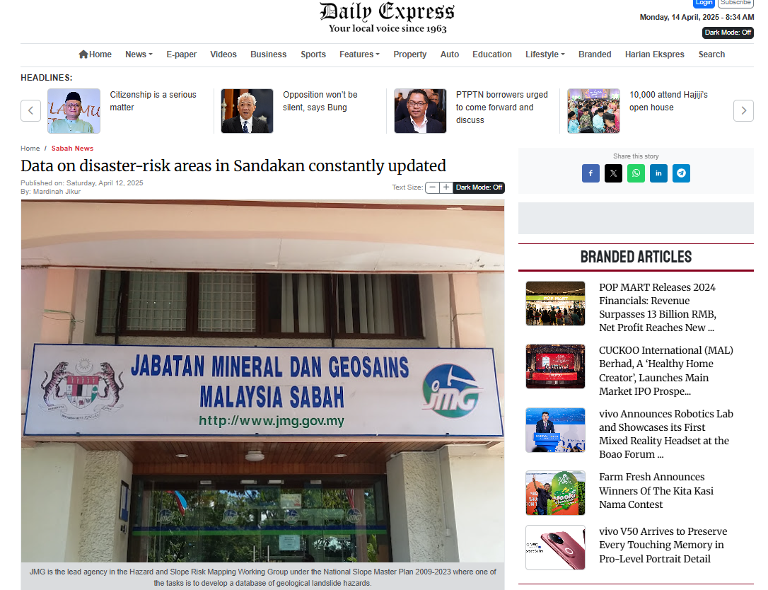
SANDAKAN: The Minerals and Geosciences Department of Malaysia (JMG) of the Ministry of Natural Resources and Environmental Sustainability (NRSES) has been constantly updating data on disaster-risk areas in this district since 2016 through the National Terrain and Slope Geospatial Information System (NaTSIS).Sabah JMG Director, Professional Geologist Frederick Francis Tating said it would also make it easier for agencies and stakeholders to know the status of slopes and ground conditions including those in Kundasang, Kota Kinabalu and Sandakan.“This is important so that those parties are aware of areas at risk of disasters such as collapsed land or slopes and earthquakes,” he said after officiating the Closing Ceremony of the National Terrain and Slope Geospatial Information System (NaTSIS) Engagement Programme with Sabah State Stakeholders 2025 and the NaTSIS Forum titled “National Geological Data: Towards Sustainable Development Planning and Disaster Management” at the Pavilion Hotel, here, on Thursday.


The forum also featured him as a panelist with the Deputy Dean of FSSA Universiti Malaysia Sabah, Dr Rodeano Roslee and the Deputy Director of the Malaysian Civil Defence Force (APM) Sabah State, Lt. Col. (PA) Erwin Kinsui.


Screenshot 2025 04 11 085144

KOTA KINABALU: Sabah’s vulnerability to landslides and earthquakes has prompted a call to urgently adopt two newly ­developed geospatial systems to strengthen disaster preparedness and improve land-use planning.

The National Geospatial Terrain and Slope Information System (NaTSIS) and the Malaysian Minerals and Geoscience Geospatial Information System (MyGEM) were presented during a four-day engagement programme in Sandakan that brought together 17 government agencies.


Sabah Mineral and Geoscience Department (JMG) director Dr Frederick Francis Tating told reporters after the event yesterday that available geological data remains limited and often focuses only on disaster-prone areas such as Kundasang, Sandakan and Kota Kinabalu.

He said both NaTSIS and MyGEM allow agencies to access geological hazard data digitally, enabling more informed and proactive decision-making.

 “This information is very useful, especially in managing geological hazards like landslides and earthquakes,” he added.

The department has also worked with universities, the Public Works Department (JKR) and other technical agencies to produce a Seismic Hazard Map – a key reference used by engineers in earthquake-prone zones.

“This information is used by engineers to design earthquake-­resistant structures. We’ve identified several areas with a high risk of seismic activity such as Kundasang, Ranau, Kudat and Lahad Datu,” said Dr Frederick.

He said mapping of landslide-­prone zones has been ongoing since 2016 under a national project, with areas like Kota Kinabalu and Kundasang already assessed and shared with local authorities.

In Sandakan, a separate study is under way to assess slope ­stability and identify danger zones.

“From our initial observations, we expect this area to have potential risks. Once the study is completed, we’ll be able to determine which locations have low, moderate or high landslide hazard ­levels,” Dr Frederick said, adding that areas like Pecky Bailey are among those being actively monitored.

Sabah Rural Development Ministry deputy permanent secretary Patricia Vain said NaTSIS is already being used in development planning to avoid high-risk areas.

“NaTSIS gives us the data we need to identify areas exposed to geohazards. The government uses this to avoid building in known red zones. This helps reduce the risk from the start,” she said.

She added that when a development site is proposed, the ministry consults JMG to determine if the location carries any geological hazards.

Sabah Civil Defence Force (APM) deputy director Lt Kol Erwin @ Elverowen Kinsui said the geospatial systems are now being used in simulations and response planning.

“Geological data is extremely valuable for disaster management in Sabah and across Malaysia.

“We use this data, especially through NaTSIS, to support early planning and public awareness, particularly for communities ­living in high-risk or hotspot areas,” he said.

APM is working on a disaster command centre and plans to integrate NaTSIS for real-time monitoring and better coordination, he added.

Sabah has recorded several landslide incidents this year, mostly triggered by continuous heavy rain.
Screenshot 2025 02 19 094636

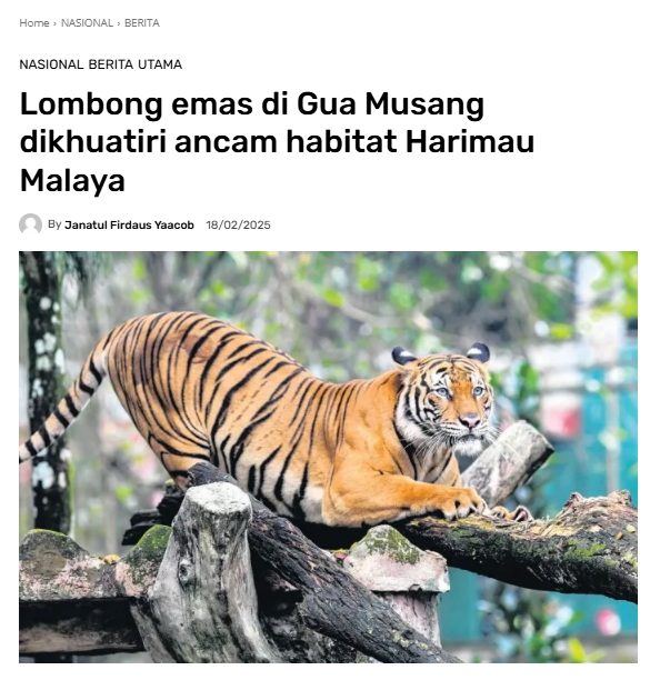
KUALA LUMPUR – Cadangan projek melombong emas di kompleks hutan Gua Musang, Kelantan akan mengancam habitat Harimau Malaya.

Ahli Parlimen Bukit Bendera Syerleena Abdul Rashid dalam kenyataan berkata, projek seluas kira-kira 145 padang bola sepak itu boleh menyebabkan Harimau Malaya yang tinggal sekitar 150 ekor di habitat liar, diancam kepupusan.

“Adakah kita bersedia mengorbankan khazanah semula jadi dan identiti yang dilambangkan oleh Harimau Malaya demi keuntungan ekonomi jangka pendek?

“Aktiviti perlombongan yang dicadangkan bukan sahaja mengancam kelangsungan spesies ikonik ini tetapi juga membawa risiko besar terhadap ekosistem sensitif yang menyokong pelbagai bentuk kehidupan,” katanya.

Syerleena memetik contoh lombong Grasberg di Papua, Indonesia, dengan berkata kesan terhadap alam sekitar adalah ‘peringatan jelas tentang kesan jangka panjang akibat mengutamakan eksploitasi industri berbanding pemeliharaan alam sekitar’.

Beliau menggesa kerajaan meneroka alternatif yang mampan dan melaksanakan perlindungan alam sekitar yang ketat untuk memastikan pembangunan ekonomi tidak mengorbankan khazanah alam semula jadi Malaysia.

Terdahulu, sebuah portal media memetik laporan penilaian kesan alam sekitar projek itu, yang mengatakan beberapa hidupan liar terancam telah dikesan di tapak cadangan.

Menurut laporan itu, perangkap kamera dipasang selama dua bulan di lima lokasi dan tinjauan di tapak cadangan perlombongan seluas 74.56 hektar mengesan kehadiran harimau Malaya, kambing gurun, rusa sambar, siamang, dan tapir Malaya.

“Kehadiran babi hutan dan rusa di tapak projek yang dicadangkan juga menjadi kebimbangan memandangkan kepentingan kawasan ini dalam pemuliharaan hidupan liar, kerana kedua-dua spesies ini sumber makanan utama bagi pemangsa besar seperti harimau,” menurut laporan itu.

Lombong yang dicadangkan itu akan dikendalikan oleh SAH Global Sdn Bhd, manakala kontraktor perlombongan ialah Syabas Deras Sdn Bhd.

Lesen perlombongan pula dipegang oleh Gugusan Timur Sdn Bhd.

Lesen perlombongan pertama kali diluluskan oleh Pejabat Tanah dan Galian Kelantan pada 29 Mac 2019 tetapi ia tamat tempoh pada 25 Mac 2024 dan permohonan pembaharuan kini sedang dalam proses penilaian.

Screenshot 2025 02 18 073436

MIRI: Ahli Parlimen Miri Chiew Choon Man ditemani Ketua Pengarah Jabatan Mineral dan Geosains (JMG) Malaysia Datuk Zamri Ramli mengadakan lawatan tapak ke kawasan tanah runtuh di sekitar Kampung Lereng Bukit dan Kampung Haji Wahid yang masing-masing terletak di kaki dan atas Bukit Kanada pada Jumaat.

Rombongan turut ditemani wakil dari Kementerian Sumber Asli dan Kelestarian Alam (NRES) dan Agensi Pengurusan Bencana Negara (NADMA).

Chiew memberitahu, lawatan bertujuan untuk meningkatkan pemahaman dari sudut teknikal dan kaedah yang akan digunakan oleh pihak JMG dalam melaksanakan kajian penilaian keselamatan cerun dan risiko tanah runtuh di kawasan berkenaan.

Menurut Chiew, sepanjang lawatan, pihak JMG bersama para pakar dan pegawai teknikal telah memberi penerangan yang terperinci mengenai keadaan cerun, jenis tanah, dan kejadian tanah runtuh yang pernah wujud di sekitar bukit tersebut.

"Mereka turut menerangkan beberapa faktor penyumbang kepada kejadian tanah runtuh, struktur geologi, aliran air bawah tanah dan cuaca," jelasnya.

Dalam sesi perkongsian itu, Chiew berkata, beberapa cadangan turut dibincangkan sebagai rujukan kepada penyelesaian isu tanah runtuh di sini.

Chiew memberitahu, sebagai Ahli Parlimen Miri, beliau terus berusaha untuk bekerjasama dengan kementerian dan agensi berkaitan bagi mendapatkan sokongan dan peruntukan kewangan yang mencukupi.

Langkah itu katanya, penting untuk memastikan sebarang langkah penyelesaian yang disyorkan dapat dilaksanakan secara menyeluruh, seterusnya mengelakkan tragedi berulang serta menjaga kebajikan penduduk terlibat.

"Saya juga mengalu-alukan laporan penuh daripada JMG setelah kajian ini selesai dilaksanakan.

"Hasil laporan tersebut akan menjadi panduan utama untuk tindakan susulan yang lebih bersasar dan berkesan," jelas Chiew.

Beliau akan terus memantau rapat perkembangan kajian ini dan memastikan apa sahaja keputusan yang dicapai kelak benar-benar memberi manfaat kepada penduduk.

Keselamatan dan kesejahteraan komuniti di Kampung Lereng Bukit, Kampung Haji Wahid, dan kawasan sekitarnya akan terus diberi perhatian, katanya.

"Usaha kita untuk mencari penyelesaian terbaik akan berterusan sehingga kehidupan penduduk terjamin dan selamat daripada risiko tanah runtuh," jelasnya lagi.


oleh Steve Annuar

Screenshot 2025 02 12 075013

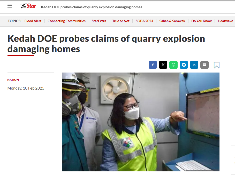
ALOR SETAR: The Kedah Department of Environment (DOE) has launched an investigation into a reported quarry explosion in Bandar Baru, which allegedly caused damage to nearby houses.

Its director Sharifah Zakiah Syed Sahab (pic) said the department conducted an on-site investigation at the quarry and affected residences on Friday after receiving information and media inquiries.


“I was referring to a news article last Friday about claims that a powerful explosion occurred at a quarry in Bandar Baru, last Wednesday, resulting in damage to nearby houses.

“Initial investigations found that no formal complaint had been lodged with the DOE regarding the incident.

“Checks with the state Minerals and Geoscience Department (JMG) also confirmed that no reports had been filed with the agency,” she said in a statement yesterday, reported Bernama.

She added that a police check found that the complainants had filed a report the following day, citing damage to their homes allegedly caused by the quarry explosion.

“The DOE’s review of the quarry explosion records, including peak sound pressure levels and peak vector sum parameters, confirmed that noise and vibration levels were within the prescribed limits.

“Noise and vibration measurements were also conducted at the complainant’s residence, approximately 650m from the blast site.

“Following discussions, the quarry has agreed to cover the cost of repairing the complainants’ houses, despite adhering to the buffer zone requirements – maintaining a distance of over 500m – and complying with noise and vibration limits. However, the impact on residential properties cannot be overlooked,” she said.

Sharifah Zakiah added that the DOE will intensify monitoring of the quarry’s operations, and collaborate with relevant agencies to propose remedial measures, to prevent similar incidents in the future.

“As a precaution, a notice under Section 37(1)(d) has been issued, requiring the developer to submit reports on blasting activities and control measures implemented at the site.

“They have also been instructed to strictly adhere to all regulations and promptly report any incidents, particularly those causing disturbances to residents,” she said.

“Complaints can be directed to the DOE via the toll-free hotline at 1-800-88-2727, or through the DOE’s e-complaint system at eaduan.doe.gov.my. Delayed reporting may hinder investigations, as crucial evidence could be compromised,” she added.


Did this page help you?

Invalid Input
Invalid Input
Invalid Input